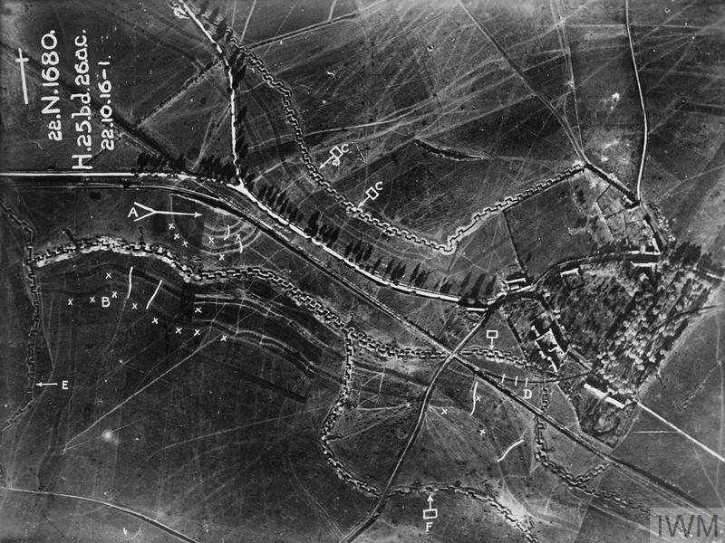
Before the dogfights, there was reconnaissance
108 years ago today, on 11 November 1918, the Armistice brought the fighting of the First World War to an end.
When the war began in 1914, the Royal Flying Corps (RFC) was primarily tasked with reconnaissance. Aircraft observed enemy movements, and aerial photography soon became an essential source of military intelligence.
As both sides recognised its importance, they began fighting for control of the skies. Reconnaissance aircraft needed protection, and fighter aviation developed rapidly.
Taking photographs was only half the job
Someone had to examine them, identify trenches, artillery positions and fortifications, compare images and determine what had changed.
Photographic interpretation became a specialised discipline, introducing techniques that would later be central to the intelligence work carried out at RAF Medmenham during the Second World War.
That legacy inspired Chinagraph.
An older story
And if you think aerial reconnaissance was new in 1914, consider this: during the American Civil War, more than 50 years earlier, the Union Army was already using observation balloons, maps and telegraph communications to report Confederate troop movements in real time.
But that's a different story.
Want to know more about the people behind the photographs? Read A profession I barely knew existed and sign up to the Chinagraph newsletter at medmenham.games.